New Tools Empower Cities to Mitigate Heat with ‘Smart’ Surfaces

Altering urban surfaces to reflect sunlight and mitigate heat can bring major benefits — not only for people's health and safety, but also for local economies and the global climate.
New research from the Smart Surfaces Coalition, supported by WRI Ross Center for Sustainable Cities, assessed the potential impacts if 10 major U.S. cities were to adopt "smart surfaces," including trees, green stormwater infrastructure, porous and permeable pavements, and reflective roofs and roads. The analysis found that these measures combined could reduce peak summer temperatures by 5 degrees F (2.8 degrees C) or more while also lowering flood risk, mitigating climate change, increasing resilience and improving public health — especially in low-income neighborhoods and communities of color.
The projected economic returns are huge: By adopting smart surfaces citywide, the 10 cities analyzed could realize $7.6 billion in public health benefits, $3.3 billion in electricity bill reductions and $9.9 billion in infrastructure savings. They could also reduce or offset 79 million metric tons of carbon dioxide equivalent (CO2e) and manage 275 billion gallons of stormwater.
However, implementing smart surfaces in cities can be challenging, with barriers like high up-front costs and a lack of clear and immediate return on investment. WRI's Urban Analytics and Data Innovation team has been working closely with the Smart Surfaces Coalition to help cities overcome these hurdles and accelerate deployment of this transformative infrastructure. Together, we developed a suite of tools that enable cities to more easily conduct cost-benefit and geospatial analyses and access the data they need to inform policies. These three tools allow users to assess local surface infrastructure, model the quantified benefits of smart surface solutions, and craft strong legislation backed by clear financial, health and climate impact data.
- The Benefit-Cost Analysis Tool enables users to explore the financial, temperature, stormwater and greenhouse gas impacts associated with adopting smart surfaces. Users are able to model impacts across a census tract, council district, city or entire metropolitan area to understand the potential benefits of these interventions.
- The Decision Support Tool (DST) empowers users to understand how surfaces, heat and hazard vulnerability are distributed across 10 metropolitan areas. The DST contains several brand-new datasets from the Cities for Smart Surfaces Program, including micrometeorological modeling of smart surface impacts and comprehensive, high-resolution analysis of land use and land cover from WRI's Urban Analytics and Data Innovation team. Staff within the 10 cities are already using this tool to help guide their policies, projects and programs.
- The Smart Surfaces Policy Tracker is a new resource that helps cities develop strong policies supporting the implementation of smart surfaces. The website features a robust, searchable database of nearly 2,000 smart surface-related policies from all 50 U.S. states that can serve as inspiration. It also hosts several policy guides, developed by Coalition partners, to improve existing policy or design new policies from the ground up.
Cities are already putting these tools to work. In June, Atlanta announced a new Cool Roof Ordinance requiring all new and repaired roofs to be built with light-colored, reflective materials. The policy is projected to cool the city by 2.4 degrees F (1.3 degrees C) in peak summer, deliver $310 million in direct energy savings and generate $760 million in net financial benefits. City leaders used model ordinance language from the Smart Surfaces Policy Tracker to shape the policy. Impact data from the Benefit-Cost Analysis and Decision Support Tools, including data provided by WRI's Urban Analytics and Data Innovation team, played a crucial role in securing unanimous adoption.
"The Smart Surfaces Coalition tools make use of new, high-resolution land-cover and characteristic datasets that equip 10 major U.S. metropolitan areas with a highly accurate, actionable view of their surface composition — empowering them to see, model and act on surface infrastructure decisions that shape climate outcomes," said Eric Mackres, Senior Manager of the Urban Analytics and Data Innovation team at WRI Ross Center for Sustainable Cities. "Through our work with the Smart Surfaces Coalition, we're putting these insights directly into the hands of local leaders, accelerating policies and investments that save lives, cut emissions and scale urban resilience."
Together, these three tools developed by WRI and SSC give cities a comprehensive, data-rich view of their surface infrastructure and clear guidance on where and how to apply smart surfaces to the greatest effect. With access to this knowledge, cities have an enormous opportunity to cool themselves down, reduce flooding, improve health and realize billions in net financial savings.
The full set of findings, including aggregate city and metropolitan-area data on cooling, cost savings, flood mitigation, air quality and public health outcomes, is available for download here. To schedule a demonstration of the web tools, please visit SSC Web Tool Access & Inquiries.
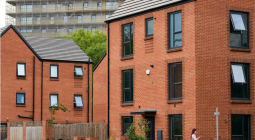
Cover photo: CHUTTERSNAP/Unsplash