Satellite Monitoring Reveals Offshore Oil Pollution Hotspots
As the oil and gas industry ramps up offshore production, researchers are using satellite monitoring to track the resulting marine damage and oil pollution, revealing impacts once hidden from view.
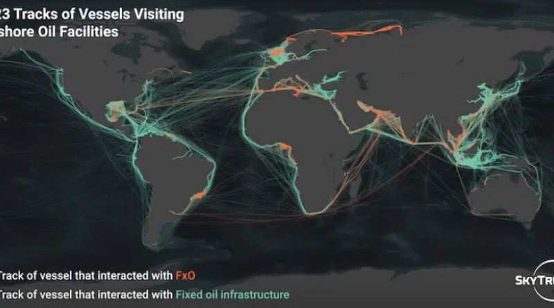
SkyTruth, a conservation technology nonprofit, partnered with Global Fishing Watch to release new satellite data revealing the most polluting offshore oil sites, as recorded during a 16-month period. “These sites stood out for the frequency and extent of oil slicks detected in satellite imagery, and together were linked to at least 216,000 gallons (over 5,100 barrels) of oil on the ocean surface,” writes SkyTruth.
The most polluting offshore oil and gas facilities were concentrated in West Africa, particularly Nigeria, which hosts five of the 10 worst sites. Multiple high-polluting facilities are also located in the United Kingdom, Norway, Angola, and the United Arab Emirates.
The analysis is part of the larger Open Ocean Project, which aims to address “a simple truth,” Global Fishing Watch says: “We can’t manage what we can’t see.”
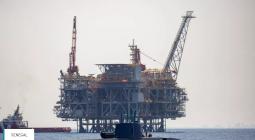
Offshore oil and gas development is expected to expand in the coming years, despite warnings that countries must cancel all new fossil fuel projects to avoid the worst impacts of climate change. SkyTruth analysts used public data and satellite images to identify offshore oil and gas facilities, including different types of floating platforms used for storing, producing, processing, or transferring oil and gas. The facilities are grouped together in their report as “FxOs.”
The analysts mapped 326 FxO locations and compiled the data with an existing dataset of 24,506 fixed oil infrastructure locations—though some were later discarded after analysis revealed they were not oil-related. Satellite imaging was essential to confirm the locations of many FxO facilities, for which no public global dataset exists.
The analysis also used available data and satellites to monitor environmental impacts, including oil spills and emissions.
Between June 2023 and October 2024, 20 offshore facilities were responsible for 228 oil slicks, spilling a cautiously-estimated 295,000 gallons of oil into the ocean. Researchers noted that while satellites can measure an oil slick’s area, they are less precise in assessing slick thickness. The report used a conservative average thickness of one micrometre and warned that the actual volume of spilled oil could be higher.
The most polluting FxO observed was the Virini Prem in Nigeria, which “showed oil slicks in 18% of all satellite images, suggesting it may release oil every five days on average.” The Princess Aweni facility, also in Nigeria, was linked to the largest volume of oil slicks.
SkyTruth also assessed emissions linked to offshore operations. Flaring by offshore oil facilities contributed about 58.7 million tonnes of CO2 equivalent. Shipping traffic to offshore facilities added roughly nine million tonnes of carbon dioxide emissions in 2023, based on at least 40,000 vessel visits.
An oil import terminal in California—Richmond Long Wharf—had the top visiting vessel emissions, while the top emitting FxO was located off the coast of Italy. Locations with the highest rates of flaring had 300 to 400 observed instances.
The analysis did not include fugitive emissions, but SkyTruth wrote that “new data from satellites such as MethaneSat and Carbon Mapper will be instrumental in future work to detect leaks from offshore oil facilities and measuring their impacts on the climate.”
Cover photo: SkyTruth