One of Earth’s most important satellites for observing disasters, climate change and environmental destruction went dark in the days before Christmas — and it's not waking up.
The loss of the Copernicus Sentinel-1B satellite threatens to hamper a host of services, businesses and research — from guiding the response to floods, to tracking oil spills and the melting of polar ice.
On December 23, the European Space Agency’s (ESA) control room in Darmstadt, Germany, detected a defect with the satellite which led to the discovery of a “potential serious problem” with the satellite's power system.
On Thursday, ESA Director General Josef Aschbacher said the problem continued, despite attempts to fix it from the ground.
“I am aware of the pressure this puts on many stakeholders around the world who depend on the data for which the Sentinel-1 constellation is known," said Aschbacher. “Investigations on this are being pursued to identify and try to remedy its root cause.”
While imagery isn't flowing, the connection between ground control and the satellite is still operational, one official familiar with the situation said. The aim now is to try to get the satellite, first launched in 2016 a couple of years after its twin Sentinel-1A, up and running again.
Sentinel-1B was launched as part of Europe’s Copernicus Earth observation network of satellites which beam down high-quality imagery of the planet's surface. That’s a central part of the EU’s space program.
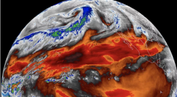
The Sentinel 1 satellites are used to track changes to the planet at both vast and local scale, in close to real time.
Researcher Kristof Van Tricht said on Twitter that if only one of the satellites were operational, large parts of the globe would lose coverage. While alternatives are available, they offer their data on a commercial basis, raising concerns for many businesses that currently rely on the EU program.
Emmanuel Pajot, secretary-general of the European Association of Remote Sensing Companies, said the loss of the satellite, if confirmed, would “be a significant blow for companies supplying time critical applications where data from both of the satellites is necessary to meet anticipated revisit times. This applies to sea-ice detection, oil spill detection and many security-linked applications.”
Ben Wallis, a researcher on glacier movement at Leeds University, said the twin satellites would typically send a picture of a location back at a frequency of up to every six days allowing him to monitor changes. With Sentinel-1B out of order that falls to one shot every 12 days.
“Some techniques become a lot more difficult over those longer baselines, and you could miss something,” said Wallis.
The radar technology the Sentinel satellites use to take images through cloud cover and in the dark (important for long polar winters) isn’t unique. National space agencies such as Japan’s JAXA and Germany’s DLR, along with private companies, also have such tech installed. The difference with the Sentinel is that all imagery is made publicly accessible for free.
“[The alternatives] have a lot less coverage than Sentinel-1 so they are not reliable for monitoring,” said Wallis. “Also that data isn’t freely available … Those other national missions, by default you have to apply for [access] and there is prioritization based on national interests.”
Wim Zwijnenburg, an environmental open-source analyst for the NGO Pax and reporting outlet Bellingcat, said the loss of the satellite would hamper researchers’ ability to monitor disasters like oil spills in warzones or major floods.
The Sentinel program is an “essential tool,” he said, because of its cloud-piercing radar capability. That means it can be used in combination with other resources to track “flooding events where cloud cover often hinders proper remote assessment, as we saw last year with Germany's flood, but also currently as we're looking at flooding in South Sudan. For humanitarian response, these data sets are essential for proper planning.”
There are plans in place to launch Sentinel-1C and 1D as part of an expansion of the Copernicus program aimed at replacing the older units. The EU set aside €5.8 billion in its current seven-year budget running to 2027 to maintain and expand the program.