Forest degradation primary driver of carbon loss in the Brazilian Amazon.
Forest degradation has become the largest process driving carbon loss in the Brazilian Amazon, according to a recent study using ESA satellite data.
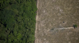
While both deforestation and forest degradation are damaging to forest health, there is a difference between the two. Deforestation occurs when forests are cleared and converted completely. When forests are degraded, their health declines and they lose their capacity to support wildlife and people.
Forests play a crucial role in Earth’s carbon cycle by absorbing and storing large amounts of carbon from the atmosphere, keeping our planet cool. However, forest degradation and deforestation, particularly in the tropical regions, are causing much of this stored carbon to be released back into the atmosphere, exacerbating climate change.
A recent study, published in Nature Climate Change, investigated the dynamics of forest carbon in the Brazilian Amazon from 2010–2019. The authors estimated that the Brazilian Amazon experienced a cumulative gross loss of 4.45 Pg C against a gross gain of 3.78 Pg C – resulting in a net loss of 0.67 Pg C of above ground biomass over the last decade.
According to co-author Philippe Ciais, “This net loss of carbon from the Brazilian Amazon forest is equivalent to seven years of fossil carbon dioxide emissions by the UK.” Philippe Ciais is also the science leader for the Regional Carbon Cycle Assessment and Processes project, as part of ESA’s Climate Change Initiative.
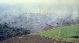
He adds, “The study shows that climate spells, like the severe El Niño of 2015, which resulted in extensive drought and heat over the Amazon, switched the carbon balance of intact forests from a sink to a large source of carbon dioxide, and so can amplify global warming.”
The authors of the study used all-weather microwave data from ESA’s Soil Moisture and Ocean Salinity (SMOS) mission, specifically vegetation optical depth dataset designed by INRAE Bordeaux, along with forest area change datasets from NASA’s Moderate Resolution Imaging Spectroradiometer and JAXA’s Phased Array type L-band Synthetic Aperture Radar.
Forest degradation – more important than thought
Over the past half century, terrestrial ecosystems have absorbed a third of year-on-year carbon dioxide emissions, despite emissions almost doubling over the same period. Tropical rainforests, including the Amazon, contributed significantly to this process as a particularly efficient carbon sink.
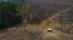
Professor Ciais points out that the study shows that human activities that ‘nibble away’ at forest carbon stocks by degradation induced by fires, logging and landscape fragmentation, contribute three times more to gross carbon loss from above ground biomass compared to deforestation.
He says, “Forest degradation is difficult to measure directly using optical satellite data because it often occurs at very small scales, for instance only the largest trees are removed by selective logging. The advantage of using the SMOS microwave data is that despite their coarse resolution, they capture the net biomass loss from all processes in a given region.”
According to the study authors, reducing forest degradation must be a policy priority in the Brazilian Amazon to reach the requirement of Reducing Emissions from Deforestation and Forest Degradation (REDD+) and the carbon emission reduction commitment of the 2015 Paris Agreement.
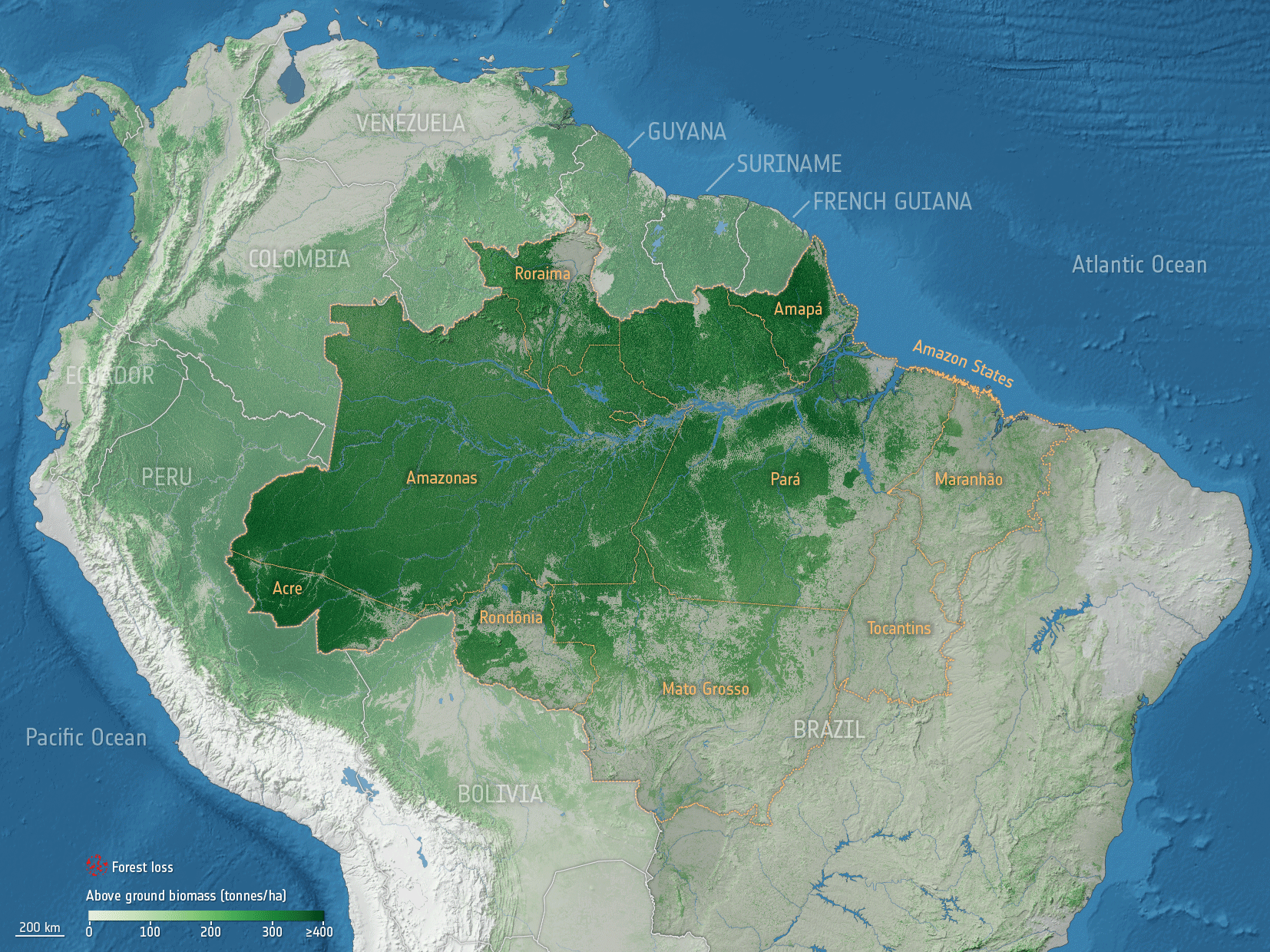
Given the importance of measuring biomass, ESA’s Climate Change Initiative has recently released a series of maps that provide a global view of above ground biomass. These maps are pertinent in helping to support forest management, emissions reduction and sustainable development policy goals.
The maps are derived from a combination of data, depending on the year, from the Copernicus Sentinel-1 mission, Envisat’s ASAR instrument and JAXA’s Advanced Land Observing Satellite (ALOS-1 and ALOS-2), along with additional information from Earth observation sources.
Looking to the future
ESA’s upcoming Biomass mission will provide crucial information about the state of our forests and how they are changing. From over 650 km above, the Biomass satellite will be able to ‘see’ through the leafy forest canopy to return information about the forest structure that can be used to calculate forest height and biomass.
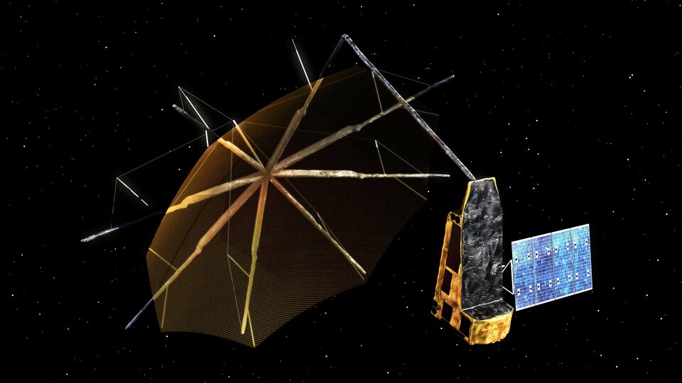
The mission will take forest counting to a new level by using a type of instrument that has never been flown in space before: a ‘P-band’ synthetic aperture radar – the longest radar wavelength available to Earth observation.
Information from the Biomass mission will lead to a better understanding of the state of Earth’s forests, how they are changing over time, and advance our knowledge of the carbon cycle.
For more information, visit the Biomass mission website.
10 June 2021
esa