International Day of Disaster Risk Reduction - High-Tech Solutions Build Resilience in Malawi
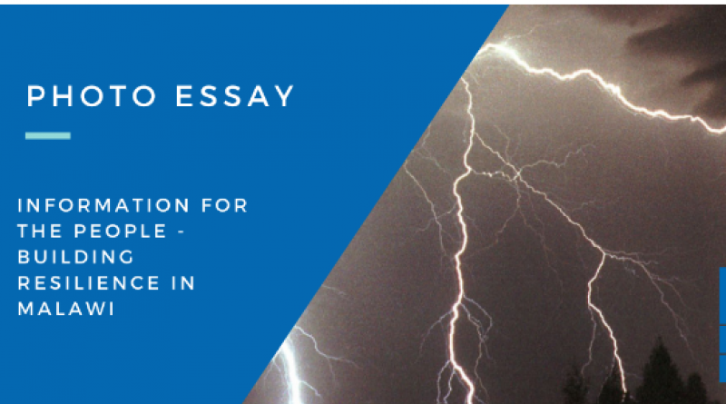
INFORMATION FOR THE PEOPLE
Participatory climate services, advanced lightning detection, solar-powered weather stations and other advanced technologies are saving lives and building resilience in Malawi
Available for syndication with attribution. View Original.
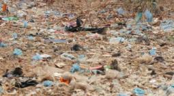
Farmers in Malawi are living on the edge. Climate change has disrupted centuries-old agricultural practices. Ever-more-intense storms put lives at risk. Floods take lives, devastate infrastructure, destroy homes and perpetuate poverty traps. And already vulnerable farmers are pushed deeper into hunger and poverty.
These risks are being multiplied many times over with COVID-19 and the global economic crisis as farmers on the frontlines of climate change struggle to survive in our fast-changing world.
To address these ever-expanding challenges, the Government of Malawi is leveraging the power of information to build resilient lives and livelihoods for Malawi’s most vulnerable populations. The innovative use of Participatory Integrated Climate Services for Agriculture (PICSA), advanced lightning detection, solar-powered weather stations and other innovative solutions are being advanced across Malawi with support from the GCF-financed, UNDP-supported “Saving Lives, Protecting Agriculture Based Livelihoods in Malawi (M-Climes)” project. Launched in 2017 the six-year project will provide 3 million Malawians with life-saving climate information and early warnings, improve food security, and advance climate resilient livelihoods. Taken together, these efforts are enhancing the nation’s ability to cope with disasters, build the foundation to recover from COVID-19, and accelerate the ambition of the country’s Nationally Determined Contributions to the Paris Agreement.
Embracing the PICSA approach
Atanazio Chasukwa is a 71-year-old farmer living on the frontlines of climate change. For Atanazio and other farmers like him, an increase in floods, droughts and fast-acting severe weather was crippling productivity and pushing resources and coping mechanism to their limits.
“We used to farm without following proper methods due to lack of information. I started farming in 1958, but I never realized high yields due to poor farming methods,” says Atanazio.
In 2018, the M-Climes project introduced Atanazio to the PICSA Approach. This innovative approach aims to help farmers to make informed decisions based on accurate, location-specific climate and weather information, including the adoption of locally relevant crop, livestock and livelihood options. By building participatory tools for decision making, the PICSA puts sustainability and locally-driven decision making front and center.
“I started yielding bumper harvests in 2018 after PICSA was introduced to us,” says Atanazio.
To arm farmers like Atanazio with the information they need, the project formed a public-private partnership with the mobile services company Esoko to deliver actionable localized climate information and early warnings to farmers via mobile and digital platforms. Farmers are now receiving information via their phones, including life-saving information on how to prevent the spread of the COVID-19 pandemic.
The project has now trained over 20,000 lead farmers on how to leverage improved information on weather and climate patterns to improve yields and foster food security. This information extends far beyond a standard weather report, leveraging advanced forecasting and modeling to give farmers the information and tools they need to know when to plant, what to plant and when to harvest based on advanced climate models. This vital information has now been passed onto 200,000 farmers across 10 districts in Malawi.
“The PICSA platform informs us of the upcoming weather conditions, enabling us to make proper decisions and cultivate crops which do well in accordance to the forecasted weather. We now cultivate drought-tolerant crops if dry spells are anticipated and yield bumper harvests at the end of the season,” says local farmer Margaret Andiseni.
The big picture
Across the world’s least developed countries, large gaps in climate information and early warnings persist. According to WMO’s 2020 State of Climate Services Report, 6 out of 10 member countries do not have multi-hazard early warning systems.
With funding from the GCF, GEF and AF, UNDP has supported 46 countries, including 28 LDCs and 8 SIDs, in developing climate information and early warning systems. Over the past 12 years, this work has increased access to climate information for over 13 million people, seen the installation of 860 automated weather stations and installed 245 early warning systems. These projects cover a wide range of sectors and involve governments, community-based organizations and NGOs working together to deliver information and solutions for adaptation to climate variability and change.
With climate information serving as a key element for scaled up climate actions across nature, climate and energy, UNDP and its partners are working to better inform climate actions across multiple sectors, promoting evidence-based investments on everything from infrastructure to sustainable development.
Solar
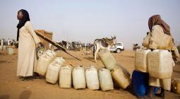
Malawi experiences frequent blackouts, and ensuring reliable energy for weather stations has always been a challenge. With the introduction of solar back-up panels, the project in ensuring 24-hour operation for its new arrays of weather stations, saving money and lowering carbon output, and enhancing the accuracy of localized weather forecasts that farmers are using to save lives and build more resilient livelihoods.
A 25 KW solar standby power system was procured and installed to support the seamless operations of the Department of Climate Change and Meteorological Services (DCCMS), which houses a number of servers and critical systems that require uninterrupted power supply.
"It is important for our Department of Climate Change and Meteorological Services to operate 24 hours non-stop so that they generate accurate information and alert people across the country of probable disasters. At first we thought solar energy will just be used for backup purposes in times of blackouts but it turned out that it is actually our main source of power aiding the operation of our systems used to capture the much-needed weather information. We are able to use the generated solar energy for about 23 hours continuously, making it our most reliable source of power," says Department of Climate Change and Meteorological Services (DCCMS) Director Jolamu Nkhokwe.
Lightning detection
New research from the American Meteorological Society’s Journal on Climate indicates that there is a rise in more severe thunderstorms in Africa as the result of rising temperatures and climate change. This increase in severe storms in taking lives and damaging valuable property.
To address the issue, a lightning detection system consisting of eight lightning detection sensors was procured and installed at the DCCMS headquarters in Blantyre. This high-tech system provides actionable real-time data so farmers and fishers can seek shelter in advance of dangerous storms. Currently, the alerts are being delivered via email, with plans to extend the coverage using mobile SMS messaging and community radio stations.
Protecting from floods
Widespread flooding killed hundreds of men, women and children, and displaced hundreds of thousands of people in Malawi in 2015 and 2019. From 2015 to date, Malawi has declared three states of national disasters from climate-related crises. Total loss and damage has cumulatively amounted to US$921 million, while recovery and reconstruction needs amounted to close to $1.4 billion.
The project is supporting the installation of 37 hydrological stations, including construction of 37 data collection platforms. Taken together, these will help control floods and reduce risks across the country as part of an expansion of the Operation Decision Support System (ODSS) in the central and northern catchments. This advanced data is used to forecast floods downstream, predict water scarcity events for water boards and irrigated farms, and generate a better picture of the nation’s river and water systems.
The project intends to expand the flood forecasting functionality of the Operational Decision Support System – installed as part of Shire River Basin Management Programme (SRBMP) financed by the World Bank – to river basin catchments in the central and northern region of Malawi. Following a review of the system it was decided to expand the flood forecasting functionality of ODSS in a phased manner by incorporating weather forecasts and automating monitoring data from automated weather stations and hydrological sensors. In the first phase the system will be expanded to cover two river catchments (Linthipe and Bua) in the Central region of Malawi.
“The new sensors installed in the central and norther region including the manual readers for river levels installed at the data collection platform play a huge role in forecasting and controlling floods. This informs infrastructure development that is linked to water levels,” says M-Climate Monitoring and Evaluation and Knowledge Management expert Ted Nyekanyeka.
Protecting the fishers of Lake Malawi
Lake Malawi has notoriously bad weather. Every year dozens of fishers lose their life to strong winds, big waves and unpredictable storms. The project installed two lake-based weather buoys in Lake Malawi. The weather, wave and wind data acquired from the buoys will be used by the DCCMS to generate safety advisories for thousands of people who use the lake and engage in fishing activities. The buoys will also monitor water quality in the lake such as salinity, turbidity and oxygen levels.
In this way, climate information isn’t just building climate resilience and ensuring food security, it’s also protecting life below water and on land, and building the strong institutions needed to build a low-carbon, climate-resilient pathway for the people of Malawi.
13 October 2020
UNDP