NASA: Sea Level Data
Sea Level
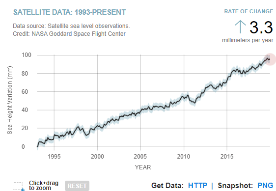
LATEST MEASUREMENT:
December 2019
95 (± 4) mm
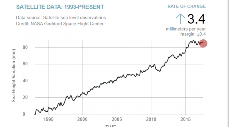
Sea level rise is caused primarily by two factors related to global warming: the added water from melting ice sheets and glaciers and the expansion of seawater as it warms. The first graph tracks the change in sea level since 1993 as observed by satellites.
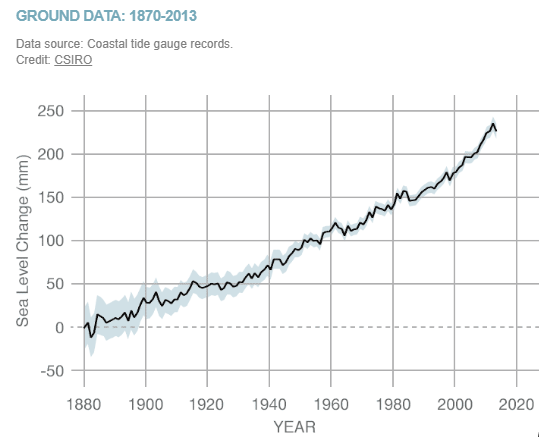
The second graph, derived from coastal tide gauge data, shows how much sea level changed from about 1870 to 2013.
The data shown are the latest available, with a four- to five-month lag needed for processing.
* You now need to create an Earthdata account to access NASA's sea level data. Register here for free. Once logged in, click the "download data" button on this page to access the data.
NASA